Showing posts with label payson. Show all posts

Monday, October 12, 2009

Great Weekend

My weekend was busy and fun and I hope yours was too. On Saturday we went up to Payson. That drive seems to be a regular one for us on the weekends. We stopped at the fruit stand again as they were getting ready to close for the day. When a tired vendor of fruits and vegetables is getting ready to pack up and go home it is a good time to shop. We got almost 2 cases of tomatoes, a case of apples, some pears and some potatoes all for $10! I have spent today making tomato sauce and trying out drying some of the tomatoes in the oven. Tomorrow I am going to make some apple pies to go in the freezer for Thanksgiving when we will have a houseful.

DSCN2461 Sunday was spent getting cars washed and going to the Cardinals game. We were treated to seats in a suite by Jim’s boss. (Thank you Tony!) It was a nail biter fourth quarter but the defense really saved the game. It was so much fun to be in the crowd on a winning day.We had a small brush with fame after the game. We ended up at the elevators at the same time as John McCain and one of his daughters. Jim shook his hand. I didn’t get the camera out and ask for a picture because I figure every one needs a day off. We wondered later if senators have some secret safety products to protect them when needed when they are out in public. There were some quiet guys in suits around but I really don’t know if they were part of his group or not.

Sunday, May 10, 2009

The Long Way Home


View Larger Map
I hope you all had a pleasant weekend. I know I did. On Friday after Jim got off work we went to Payson and spent the night. Leaving Payson on Saturday we did something that is not so unusual for us. We decided to follow a road and just see where we ended up. Going north on the Beeline Highway (Highway 87) I lost track of how many climates we went through. The highest sign I remember was about 7500 feet elevation. It was beautiful among the pine trees. Going down toward I-40 we reentered desert and drove towards Flagstaff.

Along the way I saw the sign for the impact crater. Just because it was one of our wandering around to see what we can see, take the long way home trips we decided to stop. You can take a guided walk along the rim and learn more about what happened here. The walk is about 1 mile total and only goes part of the way around. If you go you will want to wear closed shoes for the gravel path and forget about your hair because it is usually windy.

After leaving there we went to the junction of I-17 and headed south. That really isn't such a pretty way to come back into Phoenix so we cut across on highway 260 back to Payson, had dinner at a Mexican restaurant and came the rest of the way home. You can see on the map the trip we took. We left Payson before noon and got home about 7:30 that evening.
,
Sunday was a nice quiet day. I got Jim to help me hang some curtains. He did some yard work. We actually watched a movies without going to sleep. We grilled some turkey burgers and had them with sweet potato fries. How is that for a summer time version of Thanksgiving?

Tuesday, September 23, 2008

More Travels

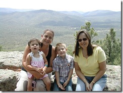
DSCN2210I am sharing with you more of the visit with my daughter in August. We took a drive to the Mogollon Rim to show it to them one day. That is where Jim took the picture of the "dog rock" I showed you in a previous post. The edge of the Rim is right behind us and Grandpa who is very afraid of heights made sure we had the kids right beside us. Not that Mom and Grandma weren't careful but he was just understandably worried. There are no guardrails or protections of any kind here.

DSCN2215We had a late breakfast at the Beeline Cafe on the way through Payson. Highway 87 is known as the Beeline Highway and the cafe is right on that road as it goes through town. It is a fun place with the meals that I have had there well prepared.

We made a quick stop at Saguaro Lake. The day was hot even by the lake so we took a few pictures and then headed home. I amazes me still to think of the beautiful lakes we have around here in the middle of the desert. I keep thinking we should get a boat but Jim says his work hours are too long and we wouldn't have time to enjoy it. I suppose he is right.

I want to try and find an Etsy item to go along with each of my posts. Today I am adding this beautiful sunset on a lake picture. Clicking on the picture will take you to EllaPhante's shop on Etsy if you are interested.

Tuesday, September 9, 2008

The Rim

We took a drive beyond Payson, Arizona one day just wandering around. Our intention was to get a glimpse of the Mogollon Rim. I have seen parts of it in pictures online and wanted to see it in person. There is, I understand a road that can take you to some of the most scenic spots. Following this route on a dirt road after some major rains was said to be a bad idea by the waitress we talked to in a local diner. She sent us up highway 260 to a ranger station and an overlook area with paved roads. We followed her directions and were stunned by what we saw. It was so beautiful. We want to complete the tour of this area sometime when the other more scenic road is less likely to be a muddy river.

As we were walking along taking pictures with cell phones because we forgot cameras we saw a storm coming our way in the distance. Jim took this picture with his phone and we didn't realize what was in it until we saw the large version of it on his computer. Take a look-- do you see the dog? The rock in the center of the picture looks to us like a dog with his ears laid back. I am sure many others have discovered our "dog rock" but it was new to us. If you want to know more about this area this is what Wikipedia has to say.
The Mogollon Rim (pronounced /mʌɡɨˈjɒn/ by local residents) is a topographical and geological feature running across the U.S. state of Arizona. It extends approximately 200 miles (320 km) from northern Yavapai County eastward to near the border with New Mexico.[1]

[edit] Description
The Rim is an escarpment defining the southwestern edge of the Colorado Plateau, and along its central and most spectacular portions is characterized by high limestone and sandstone cliffs. It was formed by erosion and faulting, and dramatic canyons have been cut into it, including Fossil Creek Canyon, and Pine Canyon. The name Mogollon comes from Don Juan Ignacio Flores Mogollón, Spanish Governor of New Mexico from 1712-1715.
Much of the land below the Mogollon Rim lies 4000 to 5000 feet (1,200 to 1,500 m) above sea level, with the escarpment rising to approximately 7,000 ft (2,100 m). Extensive Ponderosa Pine forests are found both on the slopes of the Rim and on the plateau above. It is a major floristic and faunal boundary, with species characteristic of the Rocky Mountains on the top of the plateau, and the species of the Mexican Sierra Madre Occidental on the slopes below and in the Madrean sky islands (high, isolated mountain ranges) further south.
The Mogollon Rim's limestones and sandstones were formed from sediments deposited in the Carboniferous and Permian periods. Several of the Rim's rock formations are also found in the walls of the Grand Canyon. In many places the Rim is capped or even buried by extensive basaltic lava flows.
The Rim's uppermost sandstone stratum, the Coconino Sandstone, forms spectacular white cliffs, sometimes several hundred feet high. This Permian period formation is of eolian (windblown) origin, and is one of the thickest sand-dune-derived sandstones on earth.
Cities near the Mogollon Rim include Payson, and Show Low. It is bisected by Interstate 17 between Phoenix and Flagstaff. The eastern portion of the Rim was the site of Arizona's largest-ever wildfire in June 2002, the 470,000 acre (1,900 km²) Rodeo-Chediski fire. The Mogollon Rim was also the site of the Dude Fire that started on June 25, 1990. This fire grew to over 30,000 acres (120 km2) and killed six wildland firefighters. Other large fires have burned along the Rim since 1990, and the area's Ponderosa Pine forests remain vulnerable because of past fire suppression and fuel build-up.
Famed western writer Zane Grey lived below the Rim, with a cabin northeast of Payson, Arizona, near the small village of Christopher Creek. This cabin was destroyed by the Dude Fire in 1990. Grey's book Riders of the Purple Sage and several other of his widely read novels were either set in this general area of the west, or inspired by it.[citation needed] If one stands at certain points on the Mogollon Rim (Milk Ranch Point near Strawberry, Arizona, is one example) at sunset, there is a grand view on clear days for about 50 miles (80 km) in three directions, south, west and east. Some or all of the sweeping landscape may well appear a hue of purple as the sunlight fades.